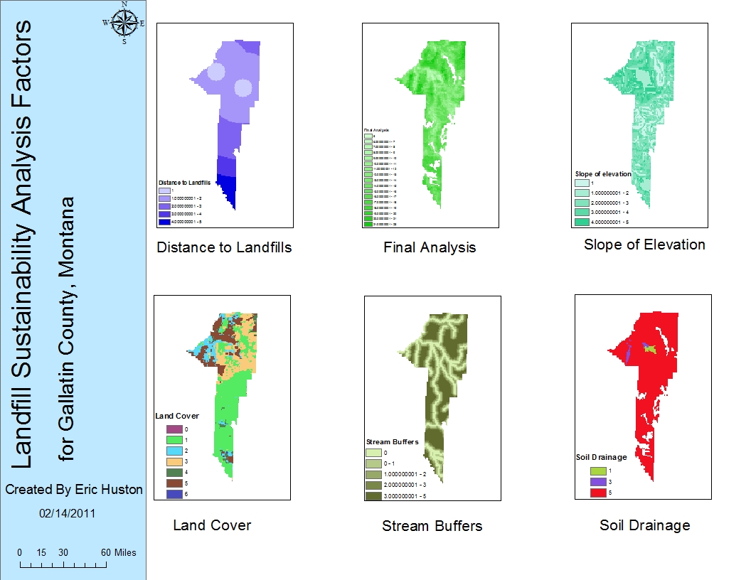
 The Sustainability exercise provides us with much useful information for projects such as construction. From the exercise, we can see that many factors are taken into account for something simple such as a landfill. We have to look at issues such as the land cover, streams, drainage, distance to the landfills and elevation.
Using the spatial analysis tool in ArcGIS, we can perform the correct analysis given the project at hand. In this case, for landfills, the spatial analysis tool was used in a variety of ways to see the impact of a landfill.
ArcGIS, if not already being implemented, would be a very good tool for politics surrounding the debate over expanding a landfill in central California. Both politicians, environmentalists, and other groups can all use this data.
ArcGIS serves us many purposes for finding and building new facilities such as a landfill. Without ArcGIS, many problems that could have been prevented would occur during the construction of a facility or afterwards. ArcGIS lets us perform spatial analysis and see much more in depth detail.
From performing this lab exercise to implementing ArcGIS in a real life scenario such as the central valley landfill situation, we can see how helpful this software really is when environmental issues arise.
No comments:
Post a Comment